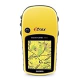
Garmin eTrex Venture HC Handheld GPS Navigator
Posted by Notcot on Apr 23, 2010 in Handhelds & PDAs |
Gizmos, Gadgets, Noir and Steampunk
Garmin eTrex Venture HC Handheld GPS Navigator
Posted by Notcot on Apr 23, 2010 in Handhelds & PDAs |
5 CommentsReply |
|
Copyright © 2024 Notcot All rights reserved. Theme by Laptop Geek. Site by I Want This Website. | Privacy Policy.
There are a few reviews of this unit knocking around, though none answered the questions I had when I was looking to buy. So having bought & used now, I thought I’d try and give the sort of review which would have helped me.
Firstly, the unit itself. Build quality is excellent – tough, weather-proof and durable. The unit is fairly small (about the size of a compact digital camera), though the colour screen is a good size and is easily readable. The high-sensitivity nature if this particular model means that it picks up satellites within 20 seconds of a cold-start, even in areas of cover (under trees etc). The accuracy is within about 10 feet. Menus are easy to use – anyone who is able to figure out how their mobile phone menus work will be able to figure this out without looking at the instructions. Battery life is very good – takes a couple of AA batteries which last for ages (still on my first set!). Also means you don’t have to mess around with chargers etc – just chuck a couple of spares in your pocket if you’re worried!
Secondly, using the unit. There are a number of comments about the basemap in other reviews. It is basic – mainly just motorways, A-roads, large water masses and towns. This is not like your car sat-nav – though it’s not supposed to be. I’ll be using the the unit when I cycle from Leeds to Liverpool along the canal. The canal isn’t on the basemap, but it will give me an idea of where I am in relation to the towns I will pass through or near. For walking/hiking, the unit is easily used with an OS map – the unit will give you your co-ordinates which you can then find on your paper map – simple. The units also has a number of other nifty features – it will track your progress automatically – and at the end of a trek (or during), will tell you how long you’ve been walking (& how long you spent standing still!), how far, average speed, top speed, etc and will show you on the unit your ‘path’ of where you’ve been.
Some walking websites also have downloadable GPS co-ordinates for their recommended walks – you can transfer these onto the unit so it will give you a route which you can follow as you go – helpful if the walk description isn’t that good!
The unit however, becomes a whole different thing when you use it with the Garmin Mapsource Topo maps, which can be bought separately (and which I have bought and used). Much is made of the cost of these maps (about £100 for entire UK), but they’re still cheaper than buying all the paper OS maps. The maps give you so much more detail on the unit screen (which you can zoom in-zoom out as you wish)- streets in urban areas, but paths, minor roads, railways, rivers, contour lines, etc in the ‘wilds’ – basically all you need to know exactly where you are/where you’re going without an OS map. The Mapsource software also lets you plot walking routes on your PC which you can then transfer, with the maps, onto your unit.
There are comments in other reviews saying that this unit, because it doesn’t have a memory card, is unable to be used with the Mapsource maps. Rubbish. The internal memory size does limit the size of maps which you can transfer across, but to give you an example, the internal memory has enough space to hold detailed Topo maps to cover about four fifths of the Lake District National Park – quite some area. Maybe not good enough for anyone walking along distance (Pennine Way, etc), but certainly more than enough for the day-walker.
I hope this helps. In short, excellent item when used with paper OS maps, and a wonderful, amazing unit if you splash out and use with the Garmin Mapsource Topo software.
Rating: 5 / 5
For several weeks I have been considering purchasing a satnav specifically for walking. I had been unable to find one in any store and so been unable to see exactly what I was buying. In desperation I settled for the Garmin Venture HC.
Using a map and compass is fine, and can never be totally replaced, but several times recently I have managed to get comprehensively lost. In theory with a couple of landmarks, a map and a compass it should be easy to work out where you are, in practice it is not so easy, landmarks can be hard to comeby or even not available (visible) at all.
The ability of the eTrex Veture HC to give a grid reference to 5 digit accuracy vertical and horizontal with WAAS correction (whatever that is) means that your map position can be fixed to within 10ft. That is quite enough to locate your position on any 1:25000 OS map.
The ability to track your exact location and to back track if necessary is more than useful. The built in odometer, compass and clock means that you can keep track of distance travelled and time spent with absolute accuracy.
As yet I have not invested in the detailed maps, but as OS maps are costing £7.99 a time (my current collection therefore valued at about £200) and are easily damaged by repeated folding and refolding I am coming to the conclusion that at £150 the full set of 1:25000 maps may well represent a good investment, and the waterproof versions cost almost twice as much.
Having done a couple of walks using the eTrex, firstly locally where I know exactly where I am, and then a walk round Macclesfield forest and up Shutlingsloe I have been very satisfied with my purchase.
Realising that the HCx model can take an external memory card and how much memory maps take I suspect that the additional cost of that model would easily be jusified. The HC has only 24Mb available. However the facilities it offers I think are well worth the cost and that is why a rate it at 4 Stars.
Rating: 4 / 5
I needed a solid, accurate and inexpensive GPS for geocaching so, after some pretty comprehensive research I eventually decided on the Garmin eTrex Venture HC. Nothing at this price can compete for the number of features and easy of use, especially as many more expensive units don’t have a colour screen or are as accurate. All readings to date have been within 10 feet or less plus I’ve never lost a signal yet, even indoors!
I was a complete beginner when it arrived but within minutes I was quite comfortable with the features and system navigation. My only (minor) gripe here is that the manual and quick setup guides aren’t as clear as they could be. Don’t be put off, just start using the device and you’ll soon work it all out.
It’s small size is very handy – about the same size a compact digital camera – and build quality is very robust. The supplied software is easy to use making uploading routes and waypoints simple. PC only though, so I have to use my wife’s laptop instead of my Mac PowerBook or just manually input any information I might need.
All-in-all extremely impressed and I would recommend this unit to anyone.
Rating: 5 / 5
Wow, what a neat product!
I have bought the Venture HC, and am absolutely delighted with it.
I use it in conjunction with OS Maps (Memory Map) on my PC and the usability of the combination is superb. I have bought the OS maps for the whole of Southern England (1:50,000) for about £42. I can then view these OS Maps on my PC (this scale shows all footpaths and bridle paths), decide on a route which I want to take, select ‘New Route’ and then click at various points along the chosen path (creating Waypoints and a path). Once I am satisfied with the route I click ‘Export to GPS’ and that route is now on my Venture. It as simple as that to load a route.
Once out and about (for me – on my bike with the bike mount kit) the Venture points me to the next Waypoint, and as I pass that it points me to the next one and so on.
When I decide to turn around (assuming I do not have a circular route) then I just tell the GPS to ‘Reverse Route’ and it takes me back again.
It gives you as much information as you like, course, speed, time and distance to next waypoint, time to Final Destination (based on your approximate speed). You can also choose which units to display this info in, Miles, KM, Nautical Miles etc, and the same for speed.
Once you have completed your journey, you can connect your GPS to your PC, and on your PC you can view the actual route you took, along with seeing the speed of various legs of your journey, altitude gained and lost along the way etc. You can even (really easily) export to Google Earth and see the journey you have made, clearly marked.
For clarity, the OS (Memory Map) Maps which I use, do NOT in themselves transfer onto the GPS (for that you need the MapSource Maps). But the OS Maps are fantastic for plotting your route on before hand, and syncing with your GPS. I have viewed the Mapsource Maps, and whilst they are neat in that they can go onto your GPS, when viewed on the PC they far less detail than you have from the OS Maps, so I am very pleased with the selection I have made.
You also have the ability to print from the OS maps, and for me I use ‘ToughPrint Waterproof Paper’. This means I have a waterproof & crease-proof hard copy map to go with the GPS, folded into my pocket for when I need it, and the path I wish to travel loaded onto the GPS having first plotted it on the PC. This may sound hi tech, but believe you me it really is straight forward to do, and for me this is absolutely a 5 star product, and a 5 star combination. I am really delighted with this purchase.
Rating: 5 / 5
Garmin makes a great number of high quality handheld GPS devices. I particularly chose this one for hiking and remote camping uses. Specially, I purchased a 2 GB mini memory card (SanDisk) and then the Garmin US TOPO 24K (National Parks East, for starts). I was able to pick specific quadrants from the US TOPO CD software and download it to my Garmin handheld through my PC (MAC also works). It worked perfectly. I will admit that the learning curve is high on this and I tend to get excited about electronic devices in general. This took taking the instruction manual and going step-by-step to learn all the functions available.
For starters, I simply went outside and turned it on. Within a minute I had several satellite acquisitions and was immediately shown where I was (in the world). The basic map included on the device is not that particularly detailed, so I purchased additional software data. You can read all about the functions that are installed on this unit here at Amazon. Some are marking a waypoint, finding a position, tracking, highway plans, a calendar, alarm clock, calculator, stopwatch, sun and moon schedules and various games. You also have access to its compass and a driving set-up that will tell you your speed, distance reaming (to your destination), estimated travel time, etc. If you were hiking and got lost, you would be able to backtrack your steps, as if you had left markers or `breadcrumbs’.
The unit itself is extremely well made and could survive several `drops’ and is waterproof. The display (approximately 2″ X 1.5″) is plenty for view-ability. The screen actually changes from a bright daytime screen to a nighttime mode. Every function is verified by a slight “beep”. Unfortunately, you do need to buy Garmin maps to download to the unit, as the one included is not very detailed and for additional data input, you really do need a mini memory card. But for the price and the number of functions, this is really a good value. Nothing beats a map and compass, but this is a great addition to any hiking that you may do. Also, for driving directions, the only thing lacking is the voice response. I highly recommend you research other Garmin models and all the accessories you might want to purchase for your personal use.
Rating: 4 / 5